SISTEMA has been at the forefront of satellite data exploitation since its inception, harnessing cutting-edge AI to transform Earth observation into actionable insights. The company has successfully developed a large range of advanced algorithms, including Super Resolution (SR) tools for Sentinel-2 imagery, deployed in critical crisis scenarios such as those in Yemen and Mozambique. Covering the entire data value chain, from acquisition to service delivery, SISTEMA brings proven expertise to this use case, which focuses on leveraging the EO4EU platform to deliver high-impact, scalable Earth observation solutions to identify the desert locust and their impact to provide and efficient humanitarian answer to an ongoing crisis happening in west Africa and northwest of India.
Commercial Motivation & Value Proposition
The EO4EU platform was created to make Earth Observation (EO) data more accessible, usable, and impactful across sectors. Desert Locust outbreaks represent a high-priority global challenge with severe socio-economic implications, especially in vulnerable regions.
Yet, existing tools often fall short in predictive capability, integration of data sources, and
scalability.
This use case directly aligns with EO4EU’s mission by showcasing how advanced AI/ML models, integrated EO/climate data, and scalable cloud/HPC infrastructure can be orchestrated into a powerful, end-to-end solution for real-world crisis management.
Key value delivered through EO4EU includes:
- Accelerated Development: The platform streamlines the integration of satellite (e.g., Sentinel), climate (e.g., ERA5), and ground data for faster prototyping and deployment of ML model.
- Seamless Data Fusion: EO4EU enables the combination of EO and climate datasets into a unified processing pipeline.
- Ready Infrastructure: Supports the training and deployment of advanced models (e.g., GRU + Maxent) with built-in HPC resources and automation.
- Scalability & Replicability: the locust service built on EO4EU can be easily extended to new regions or adapted to other biological threats and environmental risks.
Scalability & Exploitation Potential
The Desert Locust monitoring and prediction use case, developed within the EO4EU platform, is designed with scalability and commercial exploitation at its core, enabling wide adoption across sectors, regions, and use cases.
- The solution can be easily extended to other locust-prone regions across Africa, the Middle East, South Asia, and even emerging risk zones impacted by climate change.
- The solution can be use for other migratory pests and crop diseases, ecological modeling for biodiversity and habitat suitability and/or for predictive analytics for climate-sensitive phenomena (e.g., vector-borne diseases)
Current status
Leveraging the EO4EU platform, SISTEMA has developed a robust, end-to-end pipeline capable of collecting, processing, and feeding satellite and ground data into an advanced machine learning model to deliver actionable insights. For this use case, SISTEMA created a hybrid model that combines a Recurrent Neural Network (GRU) with Maxent, a powerful statistical technique, to predict the early development stages of Desert Locusts, namely Hoppers and Bands. The model was trained and validated using FAO Locust Watch dataset, historical locust data from 2000 and 2021.
By automating the entire data lifecycle, from satellite data collection to model-driven forecasting, this pipeline helps users to make smarter, faster, and more cost-effective decisions.
Techical Details
- Overview
-
The proposed use case represents an advanced information service for assessing and predicting the impact of Desert Locust plagues, designed to support NGOs, international institutions, and decision-makers with timely, data-driven intelligence. Building on a successful pilot in collaboration with an NGO operating in Yemen, SISTEMA is enhancing its existing damage assessment tools by integrating a predictive component, empowering stakeholders to shift from reactive response to proactive prevention.
Desert Locust outbreaks are closely tied to dynamic environmental factors such as climate conditions and vegetation health. Traditionally, Earth Observation (EO) data and climate forecasting have been analyzed in isolation. SISTEMA’s innovative approach combines both datasets using cutting-edge AI and machine learning techniques to deliver a more accurate and comprehensive prediction model.This next-generation service introduces:
- Conceptual advancements through the integration of new climate models for improved forecasting.
- Technical upgrades powered by High-Performance Computing (HPC) infrastructure, ensuring scalability, speed, and performance.
The result is a robust, integrated solution that enhances locust monitoring and early warning capabilities, enabling faster, smarter, and more effective interventions on the ground.
- Challenge
-
The Desert Locust (Schistocerca gregaria), found in various parts of Africa, Asia, and the Middle East, is considered the most destructive migratory pest in the world because it is highly mobile and can form swarms containing millions of locusts, leading to devastating impacts on crops, pasture, and fodder. A small swarm (1 km2) can be made up of 80 million locusts and can consume the same amount of food in one day as 35,000 people, while a large swarm can eat up to 1.8 million metric tons of green vegetation, equivalent to enough food to feed 81 million people. Without broad scale control, conservative estimates for locust-related losses including staple crops, livestock production and asset damages are estimated at US$8.5 billion for countries in the wider East Africa region, Djibouti and Yemen.
In 2021, the Director-General of the Food and Agriculture Organization of the United Nations (FAO), QU Dongyu, has welcomed an €8 million contribution from the European Union (EU) that will enable countries in the Horn of Africa to maintain a state of readiness in the face of a possible resurgence of Desert Locusts.
To improve this kind of services, the contribution of climate forecast is fundamental to increase the reliability of climate impact prediction and to provide reliable risk information to local operators and to government institutions.
- Solution
-
The Desert Locust monitoring and prediction service that addresses both early warning and real-time crisis management, delivering critical intelligence to support timely, effective responses. This dual-response approach includes:
- Early warning, to prevent the up surging of the locusts: this answer is mostly preventive by identifying areas that shows good environmental conditions for the locust breeding.
- Situational, to follow the crisis already going on, identifying the swarms and their impact to provide an efficient humanitarian answer.
The EO4EU platform helps monitor and control desert locusts, which are insects that can cause serious damage to crops and threaten food security in many regions.
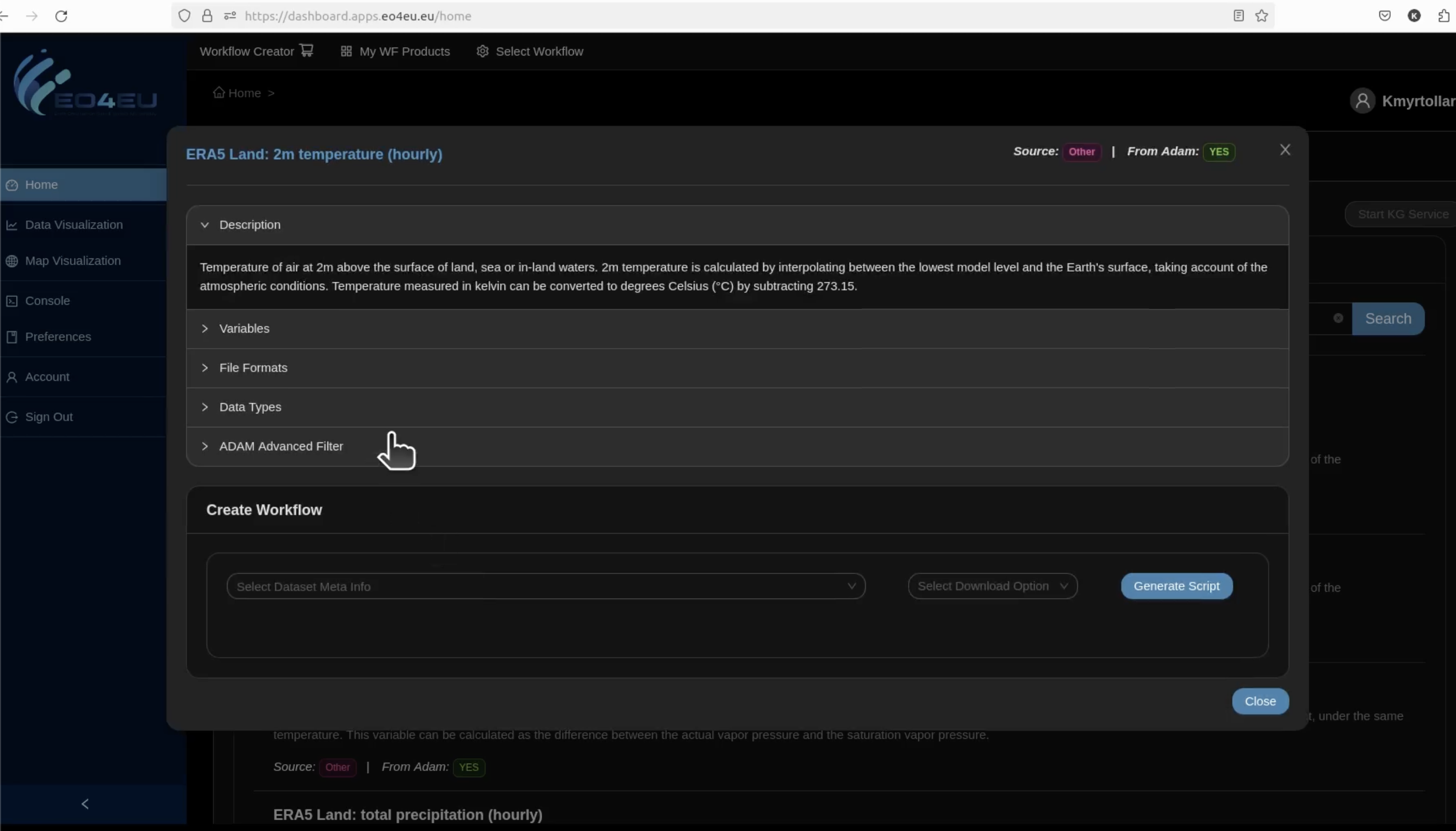
The following steps has to be follow in order to work with desert locust monitoring service on EO4EU platform:- Collecting Data
EO4EU gathers different types of information, such as:
- Satellite datasets
- Bioclimate model datasets
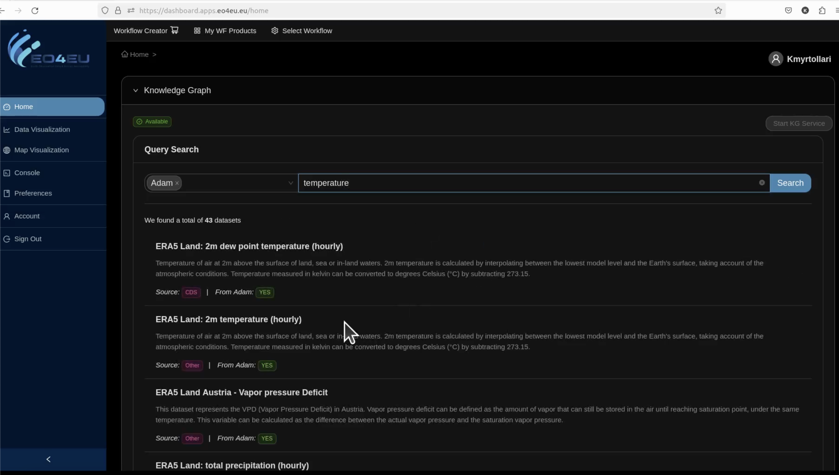
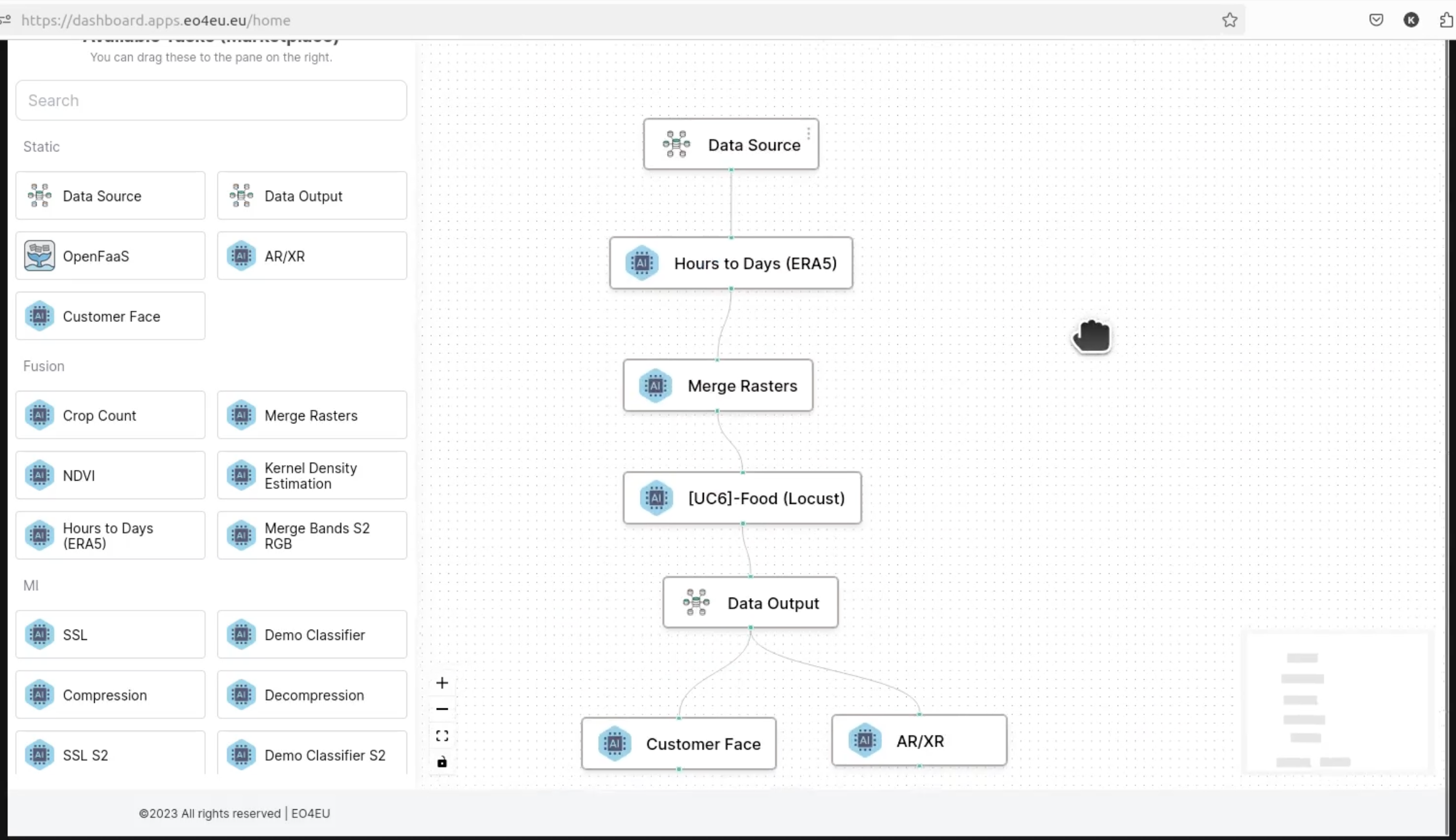
- Combining the Information
The platform fuses all these datasets into one system. This helps create a clearer and more complete picture of the locust situation.
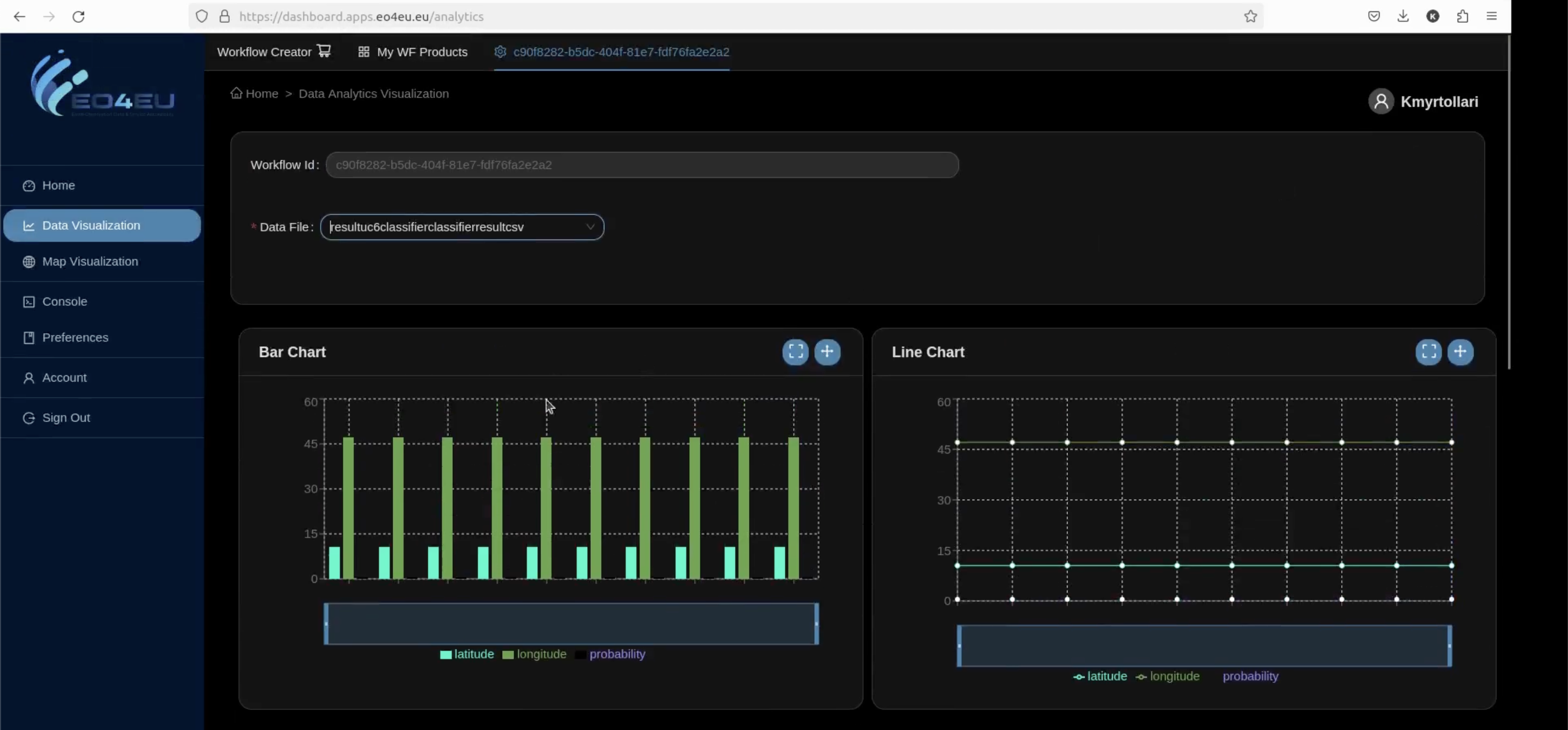
- Analyzing the Situation
With the combined data, EO4EU can map and show where desert locusts are now
Figure 1: Use case 6 workflow on EO4EU platform
Watch the workshop recording on the Environmental Pests Use Case
Input data
The input variables are:
- Soil water content layer 1 (ERA5-Land), up sampled with nearest neighbour to 5km
- NDVI (MODIS), original at 5km
- Total precipitation (ERA5-Land), up sampled with nearest neighbour to 5km
- Temperature (ERA5-Land), up sampled with nearest neighbour to 5km
The model takes as input a time series, for a single point, of 50 days previous the current date. The 50 days are divided into 10 time-steps each corresponding to a 5 days average. MODIS provide NDVI data every 8 days, so data is interpolated temporally with using bilinear algorithm.
Figure 2. Extraction of time series of climate variables on points where Desert Locusts have been reported by FAO.
Impact achieved thanks to the EO4EU Platform
Thanks to the EO4EU project the following objectives have been achieved:
- Presentation of the pest risk assessment tool at the ESA Eo4AFRICA Symposium 2024 https://eo-4-africa-symposium-2024.esa.int/
- Inclusion of the pest risk assessment tool within the International Telecommunication Union - Focus Group on AI for Natural Disaster Management and presentation to the ITU/WMO/UNEP Workshop on "Resilience to Natural Hazards through AI Solutions"( https://www.itu.int/en/ITU-T/Workshops-and-Seminars/2024/0313/Pages/default.aspx)
- The platform allows having, on the same environment, data from multiple data sources and adequate ICT capabilities (CPU/GPU) to train and run the model.
Watch the workshop recording on the Environmental Pests Use Case


This use case aims to reduce the technological gaps of the service, reaching a larger processing capability with a better reliability of the information content.